
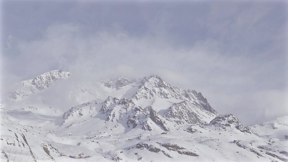
How to Prepare for a Splitboarding Expedition?
Proper preparation for a splitboarding expedition is the key to success and safety.
Check out how to do it in 4 simple steps:


Check the Avalanche Report (AR).
Before every splitboarding tour that takes you off marked trails and routes, it is essential to carefully review and analyze the current Avalanche Report (AR).
Simply reading the report is not enough! You need to extract key information and incorporate it into your tour planning to make informed and safe decisions in the field.
The avalanche report summarizes weather conditions and snowpack structure, providing a comprehensive risk assessment of the current avalanche situation. All avalanche hazard reports in the Alps and the Tatras follow a standardized format, allowing for systematic analysis and consistent application. Additionally, pictograms in the report header make it easy to understand critical information, even without knowledge of foreign languages.
HOW HIGH IS THE AVALANCHE RISK?
For many, analyzing the AR is limited to determining the danger level, which indicates the overall risk in a given region on a scale from 1 (low) to 5 (very high).


USING PROBABILISTIC METHODS
By applying probabilistic methods such as Snowcard, Stop or Go, and the reduction method, it is relatively easy to obtain a comprehensive risk assessment.
However, even if you only consider the danger level, you should remember that it is adjusted regionally. For example, the avalanche situation report may indicate different levels of risk. In the Low Tatras, the danger level might be 2, while in the High Tatras, it could be 3—or vice versa—depending on the area, altitude, or even the time of day. That’s why carefully reviewing avalanche reports is crucial to accurately assessing the risk.
For more information, visit:
🔗 https://www.avalanches.org/
WHERE ARE THE DANGEROUS AREAS?
The Avalanche Report (AR) also provides valuable information essential for route planning and decision-making in the field, such as:
Particularly dangerous slope aspects are symbolized by a black/gray wind rose.
Hazardous terrain features and elevations are indicated using text or pictograms. However, this information is useful only if the user can recognize and avoid these areas in real life.
The "Where" section also specifies the additional load required to trigger an avalanche—ranging from "spontaneous" in the worst case to "small" (a single person) or "large" (a group without spacing). This allows for a preliminary assessment of precautionary measures such as "descending one by one" or "walking with spacing".
WHAT ARE "AVALANCHE PROBLEMS"?
The AR also describes the main current hazards: wind slabs, fresh snow, old snow, wet snow, or gliding snow. These "avalanche problems" are visually represented by pictograms and keywords and further explained in the report text.
With this information, experts can recognize and assess the relevant hazard patterns in the terrain. However, this requires extensive knowledge and experience—some avalanche problems, such as old snow, are particularly difficult to evaluate, even for professionals.


For further details, visit:
🔗 https://www.avalanches.org/
All information in the Avalanche Report (AR) is now fully represented through numbers, symbols, maps, and pictograms, supplemented with explanatory text. This provides even more detailed insights essential for correctly assessing avalanche conditions. Therefore, reading the report carefully is highly recommended to gain a clearer understanding of the current avalanche situation.
ADDITIONAL INFORMATION
The AR also discusses the snowpack structure in-depth, particularly focusing on existing weak layers. Anyone familiar with snow and its properties will find these details extremely valuable.
For beginners, it can be interesting to see the relationship between weather development and snowpack structure, helping them better understand the processes occurring within the snow cover.
The final section of the AR covers the weather forecast and avalanche risk trends for the upcoming days. If you start your tour very early or are unable to check the latest AR, you will appreciate this information. Of course, the AR used should always be as up-to-date as possible, so checking the publication date is crucial.
WHERE TO FIND THE LATEST AVALANCHE REPORT?
Avalanche Bulletin for Polish Tatra Mountains (TOPR):
🔗 https://lawiny.topr.pl/
Avalanche Bulletin for Slovakia (Horská Záchranná Služba):
🔗 https://avalanches.sk/bulletin/latest
European Avalanche Warning Services (EAWS):
🔗 https://www.avalanches.org/
SUMMARY:
✔ Read the AR carefully and in full
✔ Assess the danger level based on region, altitude, and time of day
✔ Pay attention to hazardous areas
✔ Avalanche problem = current main risk!
✔ Filter information: What is relevant for you?
✔ Check the AR regularly! Always ensure it is up to date.

Check Weather Forecast
Mountain weather in winter can be highly unpredictable, so before heading out, it's essential to check multiple sources for current weather conditions. Here are some of the best tools for this:
🔹 IMGW – pogodynka.pl – Detailed forecasts for the Tatra Mountains.
🔹 Meteo.pl – The UM model is excellent for predicting precipitation and temperature.
🔹 TOPR Camera – kasprowy.com/kamery – Live view of current conditions on Kasprowy Wierch.
🔹 Windy.com – A great tool for checking wind strength and direction, crucial for planning a splitboard tour.
🔹 alpenvereinaktiv.com – Detailed text forecasts for the Eastern and Western Alps.
🔹 zamg.at – The Austrian Central Institute for Meteorology and Geodynamics, providing regional weather forecasts.
🔹 meteoschweiz.ch – The Swiss national weather service.
Key Weather Factors Affecting Your Tour:
Visibility
👀 Poor visibility caused by fog, snowfall, flat light, or darkness makes it nearly impossible to:
✔ Use favorable terrain features
✔ Estimate slope angles
✔ Assess on-site conditions
🚨 Low visibility is a valid reason to cancel a tour, as air rescue may not be possible.
✅ It’s often safer to stay below the treeline, where visibility is better and avalanche risk is lower.
Wind
🌬 Wind is the main factor in avalanche formation.
✔ Wind direction and speed provide insights into where snow accumulates.
✔ Strong winds reduce visibility and hinder communication in the field.
✔ Wind chill factor: At -10°C with a 50 km/h wind, the perceived temperature feels like -25°C ❄️.
Temperature
🌡 Temperature has both positive and negative effects on snow stability and avalanche risk:
✔ Fresh snowfall warming up to 0°C temporarily increases avalanche risk for 24 hours but then leads to snow settling and stabilization.
✔ Repeated warming and cooling cycles improve snow stability.
✔ Extreme cold (-8°C or lower) can preserve weak layers, keeping avalanche risk high.
✔ In spring conditions, timing is critical – avalanche risk on sun-exposed slopes rises quickly during the day.
Precipitation
🌧 Precipitation significantly affects tour planning:
✔ Wind + fresh snow = snowdrifts + poor visibility.
✔ Rain = water-saturated snowpack + worsening avalanche conditions.
✔ Avalanche risk due to fresh snow depends on both its quantity and surrounding weather conditions.
By carefully analyzing these factors, you can better plan your route and ensure a safer splitboarding experience. 🏔🏂

Plan your route and time well
How to Plan the Perfect Splitboarding Trip?
Planning
After selecting a route with the help of maps, guidebooks, online portals, avalanche reports, and experts such as mountain guides, you can begin actual planning.
In principle, planning should take place the evening before the trip. If you're working with online providers, you should save all information offline beforehand, as there is often limited signal in shelters or valleys. The same goes for GPS tracks and online maps: everything should be available in offline mode.
Ideally, the planning should involve all participants, but if that's not possible, all important information should be shared with companions before the morning start. In particular, the avalanche situation and the current report should be heard and understood by everyone, so that appropriate measures can be taken during the trip.
Example: If the avalanche report mentions settling sounds, and these sounds are audible on flat terrain, all participants should be aware of their significance and consider changing the route or canceling it.
1. Calculating Travel Time
There are general formulas for calculating walking time: Approach is calculated at 300 meters of altitude or 4 kilometers per hour. Since significant deviations can occur during winter (e.g., due to deep snow or spring ice), the trip should always be supplemented with experienced guidance. Route descriptions, ski guides, or shelter hosts can be helpful here.
The same applies to descent: strong splitboarders will need less time to descend than inexperienced ones. Generally, one-third of the time spent on the approach should be allocated to the descent.
However, any information about the route, whether from a hiking book, mountain guide, or online reports, should be considered only as guidelines. Ultimately, you will have to assess and apply them at your own risk. It’s also important to clarify whether the given times refer to both ascent and descent or just the ascent.
As mentioned earlier, all times must always be adjusted to current conditions, your level of fitness, and individual capabilities. You should regularly check your watch, especially during the trip, to make sure your schedule is actually working. Regular breaks are essential – especially when traveling in a group – to maintain performance and concentration.
Any equipment changes are also important when calculating time: this includes putting on and removing skins or wearing crampons. You should also plan for a time cushion for technically demanding sections.
2. Reading Topographic and Printed Maps
There are many apps and online maps that can be used for planning. On these digital maps, the route is shown as a track. Contour lines allow you to recognize the terrain's shape and steepness. The entire network of trails and numerous skitouring routes are marked on topographic maps, giving you a good overview and enabling you to choose alternatives if needed. Symbols, hatching, and terrain features provide lots of information on the map. Key points, which are usually mentioned in the route description, should be marked on the map so that you can find them again on the ground. It depends on where in the world you are traveling. Therefore, the appropriate map should be used.
In Europe, especially in the Alps, I use the app from the Alpenverein. This app is called Alpenvereinaktiv. The app offers Alpenverein maps in a 1:25000 scale, specifically designed for winter. You can filter them by activity, such as hiking, cycling, mountain biking, and winter sports. Additional layers are also displayed on the map: slope steepness, slope orientation, avalanche zones, avalanche situation, etc. I can only recommend this app for the Alps. There is a separate official map for Switzerland: https://map.geo.admin.ch/
3. Defining Key Points and Route Checkpoints
Example: Zuckerhütl on Stubai
01 Start: lower station of the Gletscherbahn cable car – 08:30: ascent to Schaufeljoch.
02 Descent through Gaiskarferner (first on the ski slope, then in open terrain) to a dip under the lift. Around 2750 m.
03 Ascent: Head south/southeast past the rocky head to about 2,860 m, continue east through Paffenferner to Pfaffenjoch at 3,208 m. Around the glacier ridge back south/east, passing the north wall of Zuckerhütl to Pfaffensattel at 3,344 m and here to the ski equipment storage before it gets really steep. Walk (mainly in crampons and possibly with rope protection) to the summit of Zuckerhütl at 3,507 m.
04 Descent along the rise – with the opposite access to the lift.
Required Time:
The total trip takes the whole day, even if reaching the summit takes just under 3.5 hours. However, due to the opposing ascent and several descents, you should start early – around 08:00. Taking all requirements into account, the trip lasts about 6 hours. Note: in good conditions.
Key Points:
Steep steps and slopes, gullies, rocky ridges, glacier breaks, etc.
Specifically related to the above example (Zuckerhütl):
Channel below the T-bar lift (about 35 degrees)
Last ascent to the summit
By taking into account orientation points (in the route description text) and information from map materials, you can define so-called checkpoints for avalanche situations.
The steepest area = directly below the lift on Gaiskarferner in the gully (around 35 degrees) and above P. 2860 towards Pfaffenjoch (also around 35 degrees).
Pfaffenjoch (3,208 m) is, for example, a good reference point for the schedule. You should reach it after about 1.5 hours. Reaching Pfaffensattel should take around 2.5 hours.
Another benefit of breaking the route into stages between reference points is that it makes the route easier to remember. The route points should be clearly marked so that you can find them even in fog or poor visibility. If you're prepared for the key points, you won't be caught off guard. In case of doubt, react early and turn back if necessary.
Photos of reference points can provide even better orientation and recognition on-site.
Why Are Smartphones Used More Frequently?
Smartphones have become our universal everyday device and are in constant use! The equipment is reliable, and apps are becoming increasingly practical. Countless routes are available, and you can continuously adjust orientation and locate your position on the map – even offline. In Tyrol, they even went a step further and developed their own emergency app that, with the press of a button, sends your location (via GPS coordinates) to the Tyrol control center in case of an emergency, and simultaneously establishes phone contact with them.
One downside of the widespread use of smartphones is that they don’t allow for reading a map properly, as small sections can quickly make you lose track. Free maps often lack too much information. It’s also essential to always have a battery pack to charge your phone on the go.
In general, never rely solely on your smartphone. Important information should be printed out and always carried with you in the form of a map. Therefore, once again: you must be able to independently assess all information – whether from the internet or printed guides – and use them independently.
4. Creating a Route Sketch
Now, take a piece of paper and create a sketch of the route – similar to a road map for bike tours. For some people, it’s helpful to sketch the route, paying special attention to reference points, travel times, and key points, so you know what to expect. It’s also helpful to create time-distance or time-altitude charts.
5. Weather and Avalanche Report
Familiarizing yourself with the weather and avalanche report is an essential part of any trip planning. All information (snow, wind, and precipitation) must be compared with the actual conditions on-site and taken into account during the planning stage.
6. Keeping an Eye on the Group
If you're traveling in a group, it’s important to consider the following:
Is the planning suitable for all involved?
Does everyone know what to expect during the trip?
Are the destination and route appropriate for all participants?
Is everyone ready for the trip?
7. Emergency Situation
No one wants to paint a grim picture, but it’s often enough for the group to split into a faster advance group and a slower group of stragglers, causing communication issues. Therefore, the following rule applies: everyone should have the phone numbers of people involved in the action. Radios can also be helpful for smooth communication. Equally important: the international emergency number (112) should be saved in every mobile phone – as well as the numbers for nearby shelters.
8. Gear Check
Everything is ready for the trip. Before going to bed, the last step is checking your gear and equipment. If you’re leaving early, you should also pack your backpack the evening before. Then you can calmly have breakfast and head out on the journey. Relaxed – and, most importantly, well-prepared!
Useful Links:

Can I Go on a Splitboard Trip Alone?
This is a controversial topic. While there are splitboarders who regularly go solo and enjoy the solitude of nature, it is generally not recommended, especially for beginners.
In open terrain, it’s always best to have someone with you at first — preferably someone with more experience. Going on a solo splitboard trip involves higher risks, as in an emergency, you are on your own. Especially in more remote areas, rescue efforts can be significantly delayed if you need help due to an accident. In an emergency, minutes can be the difference between life and death. That’s why many experienced splitboarders prefer to go into the backcountry only with company.
The situation is somewhat different when it comes to splitboarding on slopes or ski touring trails. The risks are much lower here, and it’s less common to travel completely alone. However, especially for beginners, it is generally wiser and more enjoyable to go on a trip with a group. This provides a sense of safety and the opportunity to learn from the experiences of others.
To ensure everyone’s expectations are met, it’s essential to discuss your plans ahead of time to avoid surprises. Make sure to clarify how fast, how long, and in what terrain you want to go!
Remember – A partner can save your life!